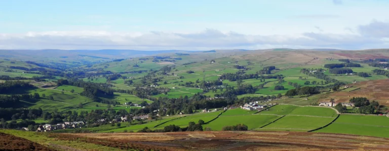
Welcome to Weardale

Weardale offers a unique landscape with peaceful moors, river walks and plenty of history and industrial heritage to charm all our visitors. This site will help you find a range of accommodation, places to eat and lots of exciting activities and attractions to visit in order to make your stay here memorable. The dale sits in the North Pennines National Landscape and UNESCO Global Geopark and wherever you are, you will enjoy wonderful views, birdlife and tranquillity.
From exciting rail journeys along the dale to visiting castles and lead mines as well as plenty of walks and cycle routes we can offer something for every visitor to enjoy.
All the businesses on this webpage are members of Weardale Visitor Network, a supportive group of local businesses who promote tourism in the area and encourage visitors to explore our beautiful region. We also have a Facebook page Discover Weardale in which we advertise events around the area, so its well worth looking there as you plan your visit. Partners of the Network include ‘Visit County Durham’, ‘Weardale Area Action Partnership’ and the North Pennines National Landscape team who attend our meetings and update us about events and happenings in the area relevant to tourism.
If you are a local business and would like to join the Network, please Contact Us or use the button on the right to get more information.